Introduction
In this article, we will first learn how to create MAPBOX account and get token from MAPBOX.
Let’s begin.
Go to https://account.mapbox.com/ and Create MAPBOX Account.
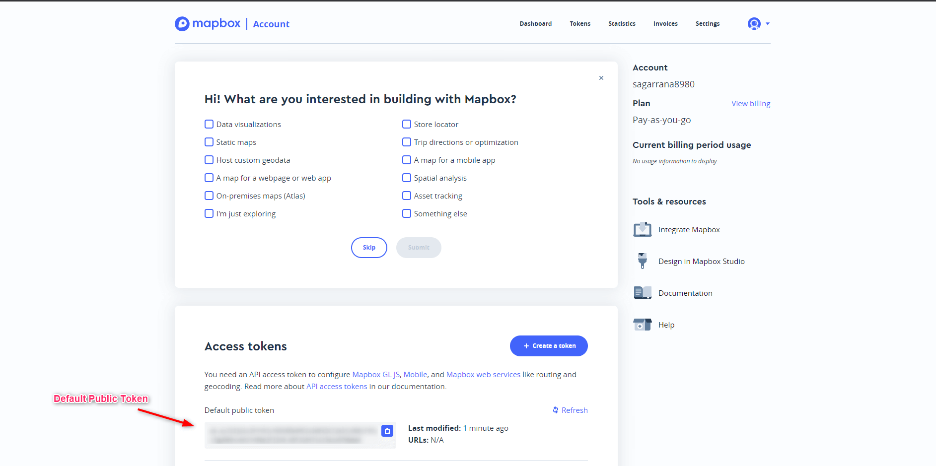
After successfully signup, the below page appears.

and you will get default public token then Create new token for with different scopes and URL.
and will be used this token integrate different Maps in MAPBOX.
Create Display buildings in 3D
Open the Index.cshtml and add the below code in it.
<!DOCTYPE html>
<html>
<head>
    <meta charset="utf-8">
    <title>Display buildings in 3D</title>
    <meta name="viewport" content="initial-scale=1,maximum-scale=1,user-scalable=no">
    <link href="https://api.mapbox.com/mapbox-gl-js/v2.3.1/mapbox-gl.css" rel="stylesheet">
    <script src="https://api.mapbox.com/mapbox-gl-js/v2.3.1/mapbox-gl.js"></script>
    <style>
        body {
            margin: 0;
            padding: 0;
        }

        #map {
            position: absolute;
            top: 0;
            bottom: 0;
            width: 70%;
            height: 50%;
            margin-top: 130px;
        }
    </style>
</head>
<body>
    <script src="https://api.mapbox.com/mapbox-gl-js/plugins/mapbox-gl-geocoder/v4.7.0/mapbox-gl-geocoder.min.js"></script>
    <link rel="stylesheet" href="https://api.mapbox.com/mapbox-gl-js/plugins/mapbox-gl-geocoder/v4.7.0/mapbox-gl-geocoder.css" type="text/css">
    <!-- Promise polyfill script required to use Mapbox GL Geocoder in IE 11 -->
    <script src="https://cdn.jsdelivr.net/npm/es6-promise@4/dist/es6-promise.min.js"></script>
    <script src="https://cdn.jsdelivr.net/npm/es6-promise@4/dist/es6-promise.auto.min.js"></script>
    <div class="row">
        <div id="map"></div>

    </div>

    <script>
        mapboxgl.accessToken = "Your Default Public Token";
        var map = new mapboxgl.Map({
            style: 'mapbox://styles/mapbox/light-v10',
            center: [-74.0066, 40.7135],
            //center: [80.3256, 27.4467],
            zoom: 15.5,
            pitch: 45,
            bearing: -17.6,
            container: 'map',
            antialias: true
        });
        var coordinatesGeocoder = function (query) {
            // Match anything which looks like
            // decimal degrees coordinate pair.
            var matches = query.match(
                /^[ ]*(?:Lat: )?(-?\d+\.?\d*)[, ]+(?:Lng: )?(-?\d+\.?\d*)[ ]*$/i
            );
            if (!matches) {
                return null;
            }

            function coordinateFeature(lng, lat) {
                return {
                    center: [lng, lat],
                    geometry: {
                        type: 'Point',
                        coordinates: [lng, lat]
                    },
                    place_name: 'Lat: ' + lat + ' Lng: ' + lng,
                    place_type: ['coordinate'],
                    properties: {},
                    type: 'Feature'
                };
            }

            var coord1 = Number(matches[1]);
            var coord2 = Number(matches[2]);
            var geocodes = [];

            if (coord1 < -90 || coord1 > 90) {
                // must be lng, lat
                geocodes.push(coordinateFeature(coord1, coord2));
            }

            if (coord2 < -90 || coord2 > 90) {
                // must be lat, lng
                geocodes.push(coordinateFeature(coord2, coord1));
            }

            if (geocodes.length === 0) {
                // else could be either lng, lat or lat, lng
                geocodes.push(coordinateFeature(coord1, coord2));
                geocodes.push(coordinateFeature(coord2, coord1));
            }

            return geocodes;
        };
        var labelLayerId;
        map.on('load', function () {
            // Insert the layer beneath any symbol layer.
            var layers = map.getStyle().layers;

            for (var i = 0; i < layers.length; i++) {
                if (layers[i].type === 'symbol' && layers[i].layout['text-field']) {
                    labelLayerId = layers[i].id;
                    break;
                }
            }

            // The 'building' layer in the Mapbox Streets
            // vector tileset contains building height data
            // from OpenStreetMap.

            map.addLayer(
                {
                    'id': 'add-3d-buildings',
                    'source': 'composite',
                    'source-layer': 'building',
                    'filter': ['==', 'extrude', 'true'],
                    'type': 'fill-extrusion',
                    'minzoom': 15,
                    localGeocoder: coordinatesGeocoder,
                    'paint': {
                        'fill-extrusion-color': '#aaa',

                        // Use an 'interpolate' expression to
                        // add a smooth transition effect to
                        // the buildings as the user zooms in.
                        'fill-extrusion-height': [
                            'interpolate',
                            ['linear'],
                            ['zoom'],
                            15,
                            0,
                            15.05,
                            ['get', 'height']
                        ],
                        'fill-extrusion-base': [
                            'interpolate',
                            ['linear'],
                            ['zoom'],
                            15,
                            0,
                            15.05,
                            ['get', 'min_height']
                        ],
                        'fill-extrusion-opacity': 0.6
                    }
                },

                labelLayerId
            );

        });
        map.addControl(
            new MapboxGeocoder({
                accessToken: mapboxgl.accessToken,
                localGeocoder: coordinatesGeocoder,
                zoom: 4,
                placeholder: 'Try: -40, 170',
                //mapboxgl: mapboxgl
            })
        );
    </script>

</body>
</html>
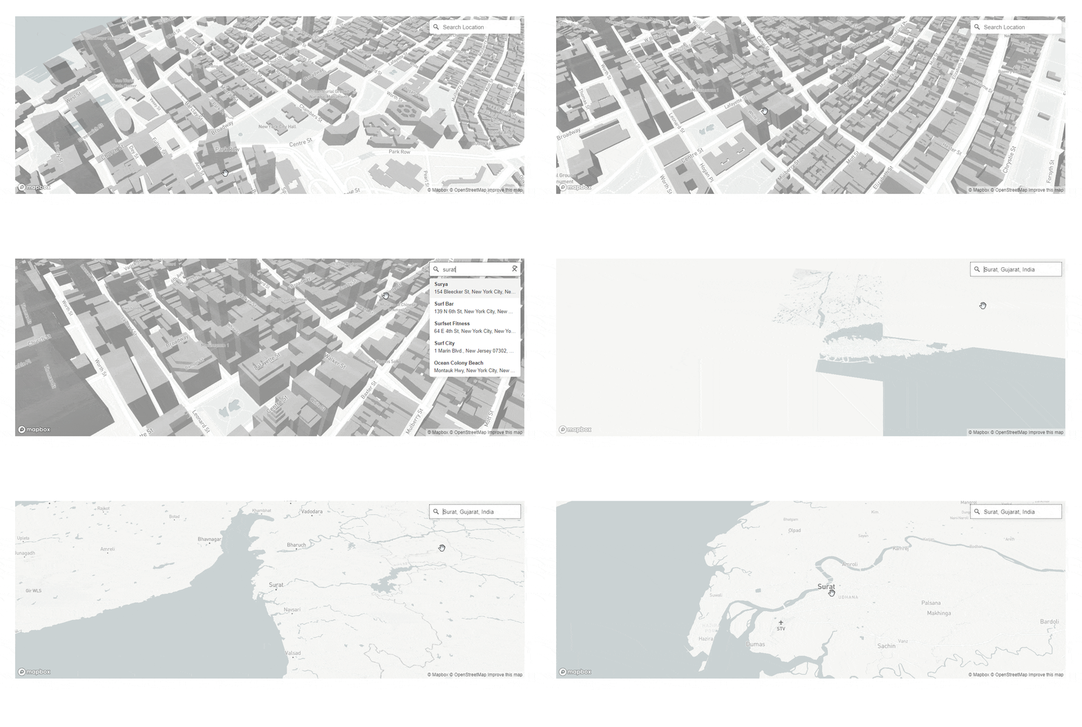
then run project and you will be appear Display buildings in 3D MAP.
OUTPUT

if you have any questions or issues about this article, please let me know and you can find more information here.


