Introduction
In this article, we will learn how to create navigation direction map (route by route) using MAPBOX.
If you have not seen the Mapbox Integration then I recommend you to refer that first.
Let’s Begin.
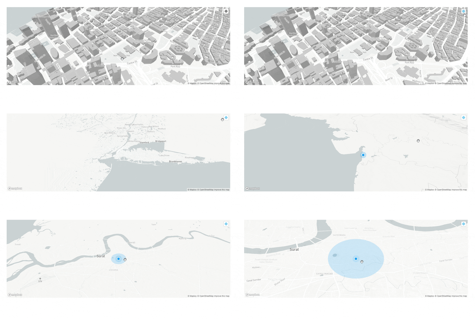
Find Current Location Option In Map
    map.addControl(new mapboxgl.GeolocateControl({
          positionOptions: {
              enableHighAccuracy: true
          },
          trackUserLocation: true
      }));
Output:

Create Navigation Direction Map
- Calculate optimal driving, walking, and cycling
- Instructions turn-by-turn
Open the Index.cshtml and add the below code in it.
<!DOCTYPE html>
<html>
<head>
    <meta charset="utf-8">
    <title>Display buildings in 3D</title>
    <meta name="viewport" content="initial-scale=1,maximum-scale=1,user-scalable=no">
    <link href="https://api.mapbox.com/mapbox-gl-js/v2.3.1/mapbox-gl.css" rel="stylesheet">
    <script src="https://api.mapbox.com/mapbox-gl-js/v2.3.1/mapbox-gl.js"></script>
    <style>
        body {
            margin: 0;
            padding: 0;
        }

        #map {
            position: absolute;
            top: 0;
            bottom: 0;
            width: 70%;
            height: 50%;
            margin-top: 130px;
        }
    </style>
</head>
<body>
    <script src="https://api.mapbox.com/mapbox-gl-js/plugins/mapbox-gl-geocoder/v4.7.0/mapbox-gl-geocoder.min.js"></script>
    <link rel="stylesheet" href="https://api.mapbox.com/mapbox-gl-js/plugins/mapbox-gl-geocoder/v4.7.0/mapbox-gl-geocoder.css" type="text/css">
    <!-- Promise polyfill script required to use Mapbox GL Geocoder in IE 11 -->
    <script src="https://cdn.jsdelivr.net/npm/es6-promise@4/dist/es6-promise.min.js"></script>
    <script src="https://cdn.jsdelivr.net/npm/es6-promise@4/dist/es6-promise.auto.min.js"></script>
    <script src="https://api.mapbox.com/mapbox-gl-js/plugins/mapbox-gl-directions/v4.1.0/mapbox-gl-directions.js"></script>
    <link rel="stylesheet" href="https://api.mapbox.com/mapbox-gl-js/plugins/mapbox-gl-directions/v4.1.0/mapbox-gl-directions.css" type="text/css">
    <div class="row">
        <div id="map"></div>

    </div>

    <script>
        mapboxgl.accessToken = "Your Default Public Token";
        var map = new mapboxgl.Map({
            style: 'mapbox://styles/mapbox/light-v10',
            center: [-80.3256, 27.4467],
            zoom: 15.5,
            pitch: 45,
            bearing: -17.6,
            container: 'map',
        });

        var labelLayerId;
        map.on('load', function () {
            // Insert the layer beneath any symbol layer.
            var layers = map.getStyle().layers;

            for (var i = 0; i < layers.length; i++) {
                if (layers[i].type === 'symbol' && layers[i].layout['text-field']) {
                    labelLayerId = layers[i].id;
                    break;
                }
            }

            // The 'building' layer in the Mapbox Streets
            // vector tileset contains building height data
            // from OpenStreetMap.

            map.addLayer(
                {
                    'id': 'add-3d-buildings',
                    'source': 'composite',
                    'source-layer': 'building',
                    'filter': ['==', 'extrude', 'true'],
                    'type': 'fill-extrusion',
                    'minzoom': 15,
                    'source': 'any',
                        'paint': {
                        'fill-extrusion-color': '#aaa',

                        // Use an 'interpolate' expression to
                        // add a smooth transition effect to
                        // the buildings as the user zooms in.
                        'fill-extrusion-height': [
                            'interpolate',
                            ['linear'],
                            ['zoom'],
                            15,
                            0,
                            15.05,
                            ['get', 'height']
                        ],
                        'fill-extrusion-base': [
                            'interpolate',
                            ['linear'],
                            ['zoom'],
                            15,
                            0,
                            15.05,
                            ['get', 'min_height']
                        ],
                        'fill-extrusion-opacity': 0.6
                    }
                },

                labelLayerId
            );

        });
        map.addControl(
            new MapboxDirections({
                accessToken: mapboxgl.accessToken
            }),
            'top-right'
        );
        map.addControl(new mapboxgl.GeolocateControl({
            positionOptions: {
                enableHighAccuracy: true
            },
            trackUserLocation: true
        }));
    </script>

</body>
</html>
Output:

If you have any questions or issues about this article, please let me know and you can check more information here.


